Categories
Blogs Culture

V. Colonial Rule: The Making of the Kingdom

One humid Sunday afternoon in Cairo, in 1921, Winston Churchill, with a mere “stroke of a pen” he would later brag, created the British mandate of Transjordan, now known as Jordan today. The Secretary of State for the Colonies was rumored to have been drinking, and his penmanship was as a result, rather wobbly

The “particularly erratic borderline” as would be described in a New York Times article by Franc Jacobs some ninety years later, created a country. A wonky, almost whimsical line delineated my homeland, Jordan. We can still see the result very visibly across the quite bizarre zigzagging of the border between Jordan and Saudi Arabia. Something that is sometimes known today as “Winston’s Hiccup” or “Churchill’s Sneeze.” “The British regarded Transjordan’s value primarily as a transit zone,” Jacobs writes, “but also as part of an aviation corridor (back when flights were short and refuelings were plentiful) between Britain and India.” The location of Transjordan’s eastern border with Iraq was also considered crucial in relation to the anticipated building of the Kirkuk–Haifa oil pipeline. 

It was in fact during their fighting with the Ottomans, that the European forces began drawing political dividing lines for colonial purposes across the landscape of the Middle East. These lines are reflective of the Middle East we know today.  These lines included hypothetical divisions that were developed by TE Lawrence, who had a vision for a liberated Arab World (which he proposed to the Eastern Committee of the War Cabinet).

Colonel Thomas Edward Lawrence, better known as Lawrence of Arabia, also had his own ideas on divisions, having served in the region. Lawrence did not immediately enlisted in the British Army in August 1914. A few months later, he was called upon by the archaeologist and historian Lieutenant Commander David Hogarth, to the newly established Arab Bureau Intelligence Unit in Cairo. He arrived to Cairo in December of 1914. At the Arab Bureau, Lawrence was responsible for supervising maps preparation, and was a consistent advocate of an independent Arab Syria. In October 1915, a crisis took hold, as Sharif Hussein, the Arab Bani Hashim tribe leader, who was, from 1908, the Sharif and Emir of Mecca, asked for a commitment from Britain to secure his rule, threatening to support the Ottomans otherwise

Sharif Hussein bin Ali Al-Hashimi proclaimed the Great Arab Revolt against the Ottoman Empire, and from 1916 to 1924 was the King of the Hejaz , and his third son Faisal was selected to lead with Lawrence, who had strategic contributions to the Arab Revolt, and liaised with the British armed forces.

Figure 18:  Map by Lawrence – November 1918

Source: Lawrence, 1918

It was thus that the Arab World suggested by Lawrence marked a “Greater Syria,” which was to be ruled by Sharif Faisal, and outlined zones which were to be ruled by his brothers Zeid and Abdullah. A competing proposal floated was that of the Sykes-Picot Agreement, where British diplomat Sir Mark Sykes and the French diplomat François Georges-Picot shaded the map to reflect zones of their respective control and influence. Central to their plan was a designated “Holy Land” and a Jerusalem under French, Italian, Russian and Greek control. Another 1947 proposal showed an internationalized Jerusalem. These ideas did not materialize, however.

General Allenby took control of the region by 1918, and the British initially rejected Sykes-Picot and developed their own temporary boundaries. France was mandated in Lebanon and Syria, and the British in Mesopotamia and west of the Jordan.

The British Mandate for Palestine, which was established at the San Remo Conference in 1920, included Transjordan, which is named from its location east of the Jordan River. The Balfour Declaration, which envisioned a Jewish homeland, was recognized by that mission. Churchill’s “stroke of the pen” separated Transjordan from the initial British mandate created in San Remo in 1920 to construct the kingdom for Sherif Abdullah. The Yarmouk River was the border decided between French Syria and British Transjordan.

Transjordan would be allowed into the mandatory region as an Arab entity, and it would not be included in the Jewish national home to be built west of the Jordan River, according to Churchill and Abdullah. In April 1921, Abdullah was appointed Emir of the Transjordan region in the area east of the Jordan. Transjordan was framed beneath the League of Nations Palestine mandate, this was modified in 1921 through Article 25, which included language that the Jewish national homeland did not apply east of the Jordan. The League of Nations by approving this meant that it gave the “Jordan” boundary that the PEF had drawn international recognition, and so the Jordan River was the border now between two independent countries. 

Figure 19:  Sykes-Picot Map

Source: Sykes-Picot Map, 1921

In 1922, the British Foreign Office marked the edges of Transjordan (which was to become Jordan) by drawing a line through the Jordan River. As Faisal was crowned the King of Iraq, Sherif Abdullah became the first Emir of Transjordan.

Conclusion

I started this project with the aim in mind to track maps of Jordan across history, finding four distinct time periods during this investigation: the ancient and biblical world, the early modern period during the Age of Discovery and Christian exploration, the Ottomans and the 19th Century, and colonial rule.

It was clear during my research that the maps of Jordan have been a consequence of the cartographer’s, rather than nature’s, decisions. Over the ages, geography and landscape have had little to do with how the maps were drafted and oriented. Starting in the biblical and ancient age, maps of Jordan reflected the worldview narrated in the Bible and were governed by a spiritual ideology. The geography of the Christian Holy Land, which imagined it as the center of the world, in a Western construct, affected how the maps were drawn, and oriented, during that time. Across the later periods, even as maps grew more scientific, from the age of the Ottomans we see administrative lines governing how maps were drafted, ignoring natural borders, such as the Jordan River, and the maps became political. The final split of the Middle East was in fact a result of the politics between the British War Office and the Palestinian Exploration Fund. It fascinates me that the map representing the Jordan I live in today is one defined almost arbitrarily by individuals, developed almost in isolation of the natural boundaries.

Sources

ACOR. “Madaba – a Short History of a Vibrant Jordanian City.” ACOR Jordan, 28 Aug. 2016, https://acorjordan.org/2015/09/17/madaba-archaeology/.  Accessed 24 April 2022.

Amaral, M. 2022. “The Colour of Time with Marina Amaral.” Substack, https://marinaamaral.substack.com/. Accessed 24 April 2022

American University of Madaba. 2022. “Madaba Overview – American University of Madaba: Official Site.” American University of Madaba | Official Site, https://aum.edu.jo/en/about-aum/history-overview/madaba-overview. Accessed 24 April 2022.

Arrowsmith, A. 2022. “Composite: A Sketch of the Countries between Jerusalem and Aleppo.” Composite: A Sketch of the Countries between Jerusalem and Aleppo. – David Rumsey Historical Map Collection. Accessed 24 April 2022.

Art Destination, 2022. “Madaba Map. Art Destination Jordan.” Art Destination Jordan, https://universes.art/en/art-destinations/jordan/madaba/madaba-map. Accessed 24 April 2022.

Arts and Culture, 2022. “Burchard of Mount Sion – Google Arts & Culture.” Google, Google, https://artsandculture.google.com/entity/burchard-of-mount-sion/m03h3p9p?hl=en. Accessed 24 April 2022.

Arts and Culture, 2022. “Fra Mauro’s Mappa Mundi – Google Arts & Culture.” Google, Google, https://artsandculture.google.com/story/fra-mauro-s-mappa-mundi/6wLizVkYn-sMLA. Accessed 24 April 2022.

Bakhit, A. 2014. “The Early Ottoman Era.” Atlas of Jordan – The Early Ottoman Era, Presses De L’Ifpo, 1 Jan. 1970, https://books.openedition.org/ifpo/5000?lang=en. Accessed April 24 2022.

Berlinghieri, F. 1482. Sixth Map of Asia. The Library of Congress, https://www.loc.gov/maps/?all=true&dates=1400%2F1499. Accessed 24 April 2022.

Blue Network, 2022. “Religion and Trade: The Role of Pilgrimage in the Levant Company.” Blue Networks: Social Networks in the Pre-Modern Mediterranean, http://mediterraneannetworks.weebly.com/religion-and-trade-the-role-of-pilgrimage-in-the-levant-company.html. Accessed 24 April 2022.

Borneman, E. 2014. “Types of Medieval European Maps.” Geography Realm, 11 Oct. 2014, https://www.geographyrealm.com/types-medieval-european-maps/.  Accessed 24 April 2022.

Britannica, The Editors of Encyclopaedia. 2008. “Notitia Dignitatum”. Encyclopedia Britannica, 9 Jan. 2008, https://www.britannica.com/topic/Notitia-Dignitatum. Accessed 24 April 2022.

Britannica, The Editors of Encyclopaedia. 2009. “Portolan Chart”. Encyclopedia Britannica, 2 Jun. 2009, https://www.britannica.com/technology/portolan-chart. Accessed 24 April 2022.

Britannica, The Editors of Encyclopaedia. 2020. “ʿAbbasid caliphate”. Encyclopedia Britannica, 5 Mar. 2020, https://www.britannica.com/topic/Abbasid-caliphate. Accessed 24 April 2022.

Britannica, The Editors of Encyclopaedia. 2021. “Battle of Lepanto”. Encyclopedia Britannica, 30 Sep. 2021, https://www.britannica.com/event/Battle-of-Lepanto. Accessed 24 April 2022.

Britannica, The Editors of Encyclopaedia. 2021. “Johann Ludwig Burckhardt.” Encyclopædia Britannica, Encyclopædia Britannica, Inc. 20 Nov. 2021, https://www.britannica.com/biography/Johann-Ludwig-Burckhardt. Accessed 24 April 2022.

Britannica, The Editors of Encyclopaedia. 2022a. Moabite Stone, https://www.britannica.com/topic/Moabite-Stone. Accessed 24 April 2022.

Britannica, The Editors of Encyclopaedia. 2022b, “Jean-Baptiste Bourguignon D’Anville.” Encyclopædia Britannica, Encyclopædia Britannica, Inc. 24 Jan. 2022, https://www.britannica.com/biography/Jean-Baptiste-Bourguignon-dAnville. Accessed April 24 2022.

Britannica, The Editors of Encyclopaedia. 2022c. “Conference of San Remo.” Encyclopædia Britannica, Encyclopædia Britannica, Inc. 12 Apr. 2022, https://www.britannica.com/event/Conference-of-San-Remo.  Accessed 24 April 2022.

Business Optimization Consultants. 2022. “The Great Arab Revolt.” Jordan – History – The Great Arab Revolt, http://www.kinghussein.gov.jo/his_arabrevolt.html. Accessed 24 April 2022.

Corpus Christi College, 1200. “Oxford Corpus Christi College MS 2*.” FORDHAM MEDIEVAL DIGITAL PROJECTS, https://medievaldigital.ace.fordham.edu/mapping-projects/oxford-outremer-map-project/interactive-map/the-manuscript/oxford-corpus-christi-college-ms-2/.  Accessed 24 April 2022.

DOA. 2009. Annual of the Department of Antiquities of Jordan. Volume 53. Accessed 24 April 2022.

Gavish, D. 1994. French Cartography of the Holy Land in the Nineteenth Century, Palestine Exploration Quarterly, 126:1, 24-31, DOI: 10.1179/peq.1994.126.1.24

Hall, S. “1835 Hall Map of Turkey in Europe.” Geographicus Rare Antique Maps, https://www.geographicus.com/P/AntiqueMap/turkeyeurope-hall-1835.  Accessed 24 April 2022.

Hall, S. 1835. “A New General Atlas with the Divisions and Boundaries”, https://www.geographicus.com/P/AntiqueMap/turkeyeurope-hall-1835.  Accessed 24 April 2022.

Harvey, P. 1997. “The Twelfth-Century Jerome Maps of Asia and Palestine: Article NNL_ALEPH004109796: The National Library of Israel.” The Twelfth-Century Jerome Maps of Asia and Palestine | Article NNL_ALEPH004109796 | The National Library of Israel, The National Library of Israel, 1 Jan. 1997, https://www.nli.org.il/en/articles/NNL_ALEPH004109796/NLI.   Accessed 24 April 2022.

Havrelock, R. 2014. “The Jordan River in Ancient and Modern Maps.” Art and Identity at the Water’s Edge, Ashgate, 23 May 2014. Accessed 24 April 2022.

Horii, A. 2018 “From Virginia to the Dead Sea: Lieutenant William Francis Lynch and the 21st Century.” Acor Jordan, 4 July 2018, https://acorjordan.org/2018/06/20/lieutenant-william-francis-lynch-and-the-21st-century/. Accessed 24 April 2022

Hussey, J. “Justinian I”. 2022. Encyclopedia Britannica, 1 Jan. 2022, https://www.britannica.com/biography/Justinian-I. Accessed 24 April 2022.

Irvine, V. 2022. “Transjordan, the Hashemite Kingdom, and the Palestine War.” Encyclopædia Britannica, Encyclopædia Britannica, Inc. 8 Apr. 2022, https://www.britannica.com/place/Jordan/Transjordan-the-Hashemite-Kingdom-and-the-Palestine-war. Accessed 24 April 2022.

Jacobs, F. 2012. “Winston’s Hiccup.” The New York Times, The New York Times, 6 Mar. 2012, https://opinionator.blogs.nytimes.com/2012/03/06/winstons-hiccup/.  Accessed 24 April 2022.

Jacotin, P. 2022. “Google Arts & Culture.” Google, Google, https://artsandculture.google.com/entity/m02q5b6d?hl=it. Accessed 24 April 2022.

Marefa, 2022. “رسم خرائط فلسطين.” المعرفة. Accessed 24 April 2022.

Masalha, N. 2019. Palestine: A Four Thousand Year History. Zed Book.

Meimaris, Y. 2013. The Discovery of the Madaba Mosaic Map. Mythology and Reality. Accessed 24 April 2022.

Montoya, R. 2011. “The Oldest Map of the Holy Land Is Actually a Magnificent Mosaic.” History, National Geographic, 4 May 2021, https://www.nationalgeographic.com/history/history-magazine/article/madaba-mosaic-oldest-map-jerusalem-holy-land.  Accessed 24 April 2022.

Moscrop, J. 2000. Measuring Jerusalem: The Palestine Exploration Fund and British Interests in the Holy Land. 1 January 2000. A&C Black

Pasha, M. 1970. “Atlas-i Cedid (the Modern Atlas) with the Text, Ucalet Ul Cografiya. 2 Vols. by Mahmud Raif Pasha – Hardcover – First and Only Ed. – 1802 – from Archive (SKU: 0005).” Biblio.com, Dar Ut Tiba’aa and Tab’ Hane-i Humayun, Uskudar, 1 Jan. 1970, https://www.biblio.com/book/atlas-i-cedid-modern-atlas-text/d/902393792. Accessed 24 April 2022.

Ptolemy. 1407. “Ptolemy’s World Map.” The British Library – The British Library, https://www.bl.uk/learning/timeline/item126360.html.  Accessed 24 April 2022.

Ptolemy. 1478. “Sixth Map of Asia.” The Library of Congress, https://www.loc.gov/item/2021668394/.  Accessed April 24 2022.

Rawashdeh, S. 2019. “Swiss Scholar Studies Ancient Map to Navigate Petra’s Past.” Jordan Times, 28 Sept. 2019, https://jordantimes.com/news/local/swiss-scholar-studies-ancient-map-navigate-petras-past. Accessed 24 April 2022.

Schelhaas, B. et al. 2017. Mapping the Holy Land: The Foundation of a Scientific Cartography of Palestine. Bloomsbury Publishing. (28 February 2017). ISBN 978-0-85772-785-5. https://books.google.jo/books?id=XhKMDwAAQBAJ&redir_esc=y

Scott, C. 2022. “Google Arts & Culture.” Google, Google, https://artsandculture.google.com/entity/m0gvsyld?hl=it. Accessed 24 April 2022.

Sebastian, M. 1545. “Terra Sancta XXIII Nova Tabula – Digital Maps and Geospatial Data.” Princeton University, The Trustees of Princeton University, https://maps.princeton.edu/catalog/princeton-kw52jc74q. Accessed 24 April 2022.

Shahid, I. 1999. “The Madaba Mosaic Map Revisited: Some New Observations.” In The Madaba Map Centenary 1897-1997. Travelling through the Byzantine Ummayyad Period, edited by Michele Piccrillo and Eugenio Alliata, 147-54. Jerusalem: Stadium Biblicum Franciscanum.  Accessed 24 April 2022.

Stanford Libraries. 2022. “Renaissance Exploration Map Collection.” Genre: Map / Language: Latin / Date: 1569 / Author: Zaltieri,+Bolognino,+Active+1555-1576 – Renaissance Exploration Map Collection – Spotlight at Stanford Search Results. Accessed 24 April 2022.

The Palestine Exploration Fund. 2022. “History”, 17 Jan. 2022, https://www.pef.org.uk/about/history/.  Accessed 24 April 2022

Tietz, T. 2020. Abraham Ortelius and the Theatrum Orbis Terrarum, 21 May 2020, http://scihi.org/abraham-ortelius-theatrum-orbis-terrarum/. Accessed 24 April 2022.

Wey, W. 1867. “Map of the Holy Land, Illustrating the Itineraries of William Wey [Cartographic Material] : Fellow of Eton in A.D. 1458 and 1462: Map NNL_ALEPH002370161: The National Library of Israel.”, 1 Jan. 1867, https://www.nli.org.il/en/maps/NNL_ALEPH002370161/NLI. Accessed 24 April 2022.

World History Encyclopedia. 2022. “Jordan Timeline.” World History Encyclopedia RSS, https://www.worldhistory.org/timeline/Jordan/.  Accessed 24 April 2022.

Yapp, M. 2022. “Ottoman Empire.” Encyclopædia Britannica, Encyclopædia Britannica, Inc. 7 Mar. 2022, https://www.britannica.com/place/Ottoman-Empire. Accessed 24 April 2022.

Ziegler, J. 1532. “Antique Map Categories.” Antique Maps by Jacob Ziegler – Barry Lawrence Ruderman Antique Maps Inc. https://www.raremaps.com/mapmaker/3777/Jacob_Ziegler. Accessed 24 April 2022.
Categories
Blogs Culture

IV. The Ottomans and the 19th Century: Shaping Jordan’s Modern Administrative Boundaries

The years 1300-1402 were labeled as a growth spurt for the Ottoman Empire. The Empire began with the Turks in Anatolia and lasted for over 600 years.  By 1402 the Ottomans controlled most of the Southeastern European, Western Asia, and Northern Africa regions. This expansion occurred after conquering the Byzantine Empire which controlled most of the land surrounding the Mediterranean Sea in addition to some of the Middle East and North Africa.

In 1516 “Bilad alSham” (the Levant) was occupied by the Ottomans. As with the earlier Islamic period, administrative divisions were used. The area came under Ottoman rule for four centuries until 1918. Niyabat al-Kerak was now known as Liwa Ajlun – basically covering the same land as modern-day Jordan. The Kingdom was divided into several “Nawahi”, al-Salt, al-Ghor, Ajlun, al-Kerak, Bani Alwan, and al-Kura, amongst others. The Jordan River, except for the north, formed the valley which was lined with continuous villages. Only in the south were there any isolated ones. Each of the Nawahi was composed of various settlements and villages, which included population groups of Christians, Muslims, and even sporadic Jews.  The whole area was under the auspices of the Province of Damascus. The pilgrimage route caravans to Mecca brought the region much stability.

Transjordan was a province of minor importance to the Ottoman Empire, between the 16th and the 19th centuries. The area was governed locally, with the safety of the Hajj pilgrimage route being of paramount importance. Starting in 1866, the Damascus Province governor, Rashid Pasha, created new administrative boundaries in Transjordan. The Qada’ of Ajlun was created, as was al-Salt. New districts were again created in 1872 with Ma’an as the capital, and updated in 1895 when al-Kerak replaced Ma‘an as the region’s capital.

The first Ottoman Empire atlas was printed in 1732 and included a copy of Katip Celebi’s map who was a geographer at the time. This map is the first detailed effort at drafting the Empire’s Asian provinces. The phrase “Land of Palestine” is written in Arabic down the River Jordan. The Ottoman Cedid Atlas by Müderris Abdurrahman Efendii shows Ottoman Syria in 1803. This map is thought to be inspired by the 1794 d’Anville map (which can be found in the General Atlas of William Faden). However, this version included additional details reflecting the Ottoman provinces. Likewise, it reads “Land of Palestine” in Arabic on it.

Figure 13: Cedid Atlas by Müderris Abdurrahman Efendi

Source: Cedid Atlas, 1803

The Carte de l’Egypte from 1799 was drafted by Pierre Jacotin, under Napoleon, who originally worked on the surveying during Napoleon’s movements in Egypt and Syria. He produced the 1st map of the Levant which was based on triangulation, and which formed the starting point for many of the subsequent maps until that of the Palestine Exploration Fund (PEF) in 1873 (which I write about below). The map is considered highly flawed, though it is a major shift from the political and biblical maps produced earlier. The boundaries shown are only physical, however where the French were unable to survey, made up details were “added to the map ad libitum.” This is especially clear with the natural landscape and mountain ranges drawn.

Figure 14: Jacotin Map of the Jordan

Source: Jacotin, 1799

By 1815, Aaron Arrowsmith, who was an English cartographer, engraver, and publisher, based on Henry Maundrell’s work from 1703, Journey from Aleppo to Jerusalem, produced “A Sketch of the Countries between Jerusalem and Aleppo”. Maundrell was an Oxford academic who had undertaken an Easter pilgrimage to Jerusalem in 1697. On the map, the description of Jacob’s Well, on the outskirts of Nablus, is a direct quotation from Maundrell. A line from the German explorer Ulrich Jasper Seetzen, from A Brief Account of the Countries Adjoining the Lake of Tiberias, the Jordan and the Dead Sea published in 1809 is also included. The map is a combination of a modern map and a biblical map, which also shows the Twelve Tribes (the twelve sons of Jacob from Rachel and Leah).

One of the earliest maps showing the Ottoman divisions was that of Sidney Hall in 1830. Hall was a British engraver and cartographer who reproduced atlases with maps of the United Kingdom and the ancient world from his engravings.

Figure 15: Hall Map 1830

Source: Sidney Hall, 1830

William Hughes was an English geographer, cartographer, author and academic who had made a career of producing maps of the region. In 1840 he published the Illuminated Atlas of Scripture Geography. Produced for the Society of the Diffusion of Useful Knowledge, an organization which prided itself on publishing information to support those who could not access formal education, the map below is almost entirely political, showing detailed illustrations of the Ottoman administrative districts.

Figure 16: Hughes Map

Source: William Hughes, 1840

In 1840 Charles Rochfort Scott, an army officer, developed the Royal Engineers map, which was drafted during the Oriental Crisis, of the Egyptian Ottoman war. This was the second time that a triangulation-based attempt was made to map Jordan. A version was prepared in 1846 for the British Foreign Office. The map was also the base for the drafting of Van de Velde’s map, which we will discuss later.

In 1841 Heinrich Kiepert, a German geographer, produced a map to be included with the first edition of Biblical Researches in Palestine by the “Father of Biblical Geography” Edward Robinson. The 1849 map from William Lynch, a naval officer, was prepared for the United States Hydrographic Office as commissioned and was published in Narrative of the United States’ Expedition to the River Jordan and the Dead Sea. Lynch was the first cartographer to determine that the Dead Sea was below sea level through using the method of triangulation, which the scientific community had previously suspected but had not been able to conclusively prove. The mission was equally cultural and promotional as it was scientific as he was tasked with understanding his surroundings more and mapping a potential route from the Mediterranean to the Dead Sea.

The 1850 Carl Zimmermann map, made by the German painter, in The Atlas of Palestine and the Sinai Peninsula, was spread over 11 lithographic maps and two geologic profiles. This continued this much more scientific trend. Charles Van de Velde in 1858 produced what became known as one of the most precise maps preceding the PEF Survey which I will discuss later.

In 1870 the French sent an expedition to map the Levant as a follow-up attempt to expand the map of Lebanon to include full coverage of Jordan. The Franco Prussian War outbreak saw the two cartographers Galilee Jean-Joseph Mieulet and Isidore Derrien recalled. The map was published in 1873. This map did not have a legend and was considered inferior to the PEF.

By the end of the Ottoman Empire, the administration had taken as many steps as possible to divide up the region, with the Jordan River as the major boundary with trade routes magnifying. As the Ottomans continued with their districting, during 1873, the Palestine Exploration Fund was made to help excavate and map the area. With Queen Victoria as the royal patron, the PEF was designed to elevate the fields of history and archaeology with research, and glean a better understanding of the geology, topography, customs and culture. Their cartography initiative was funded by the British War Office and operated by members of the Royal Engineers and was focused on the production of a scientific map that had little to do with the major archaeological efforts that the PEF had undertaken in the past. Ultimately the PEF produced the map used by British General Edmund Allenby to drive the Ottomans out, which, with some modifications, defined the initial colonial claims. This shows how the measurement and representation involved in cartography can also be used to control and define regions, and many identify this map as the first which made these claims. The PEF considered themselves geographers and were mostly unaware of how their efforts were leveraged by the War Office. The PEF were the peak of cartographic work as the first fully scientific map. While the map is said to be scientific and historically accurate, the divisive lines drawn show just how much maps are methods of exerting power and control politically.

It was clear early on to the PEF surveyors that the Jordan River was a dividing line along which urban density varied, and east of the Jordan was much sparser and less densely populated. There was a sense of “competition” between the British and French explorers within the Holy Land, and with limited resources and funding, the PEF heavily invested in mapping the region to the west of the Jordan, and as it developed.

With the American Palestine Exploration Society (APES) offering assistance, the PEF, internally expecting them to fall short, assigned them the task they expected was of less significance from a military, and biblical, perspective. This was the “eastern” survey. The PEF promptly disregarded these efforts, which made for terrain exclusively western. Thus, the boundary of the Jordan River was cemented as a lasting and permanent border, for the first time in this manner, with the Jordan River as a border.

The War Office published its maps in 1879, and the PEF a year later. The maps that PEF published were indeed biblical in their north-south and east-west axis, or “from Dan to Beersheba” and “from the Jordan to the Sea”. The area was divided with the idea of it to be ruled as a colony, and Protestant homeland.

A map of the east of the Jordan was also needed in the fight against the Ottomans, especially with the Germans building a railway from Damascus to Haifa. In 1884, the PEF published the Eastern Map of the Jordan, which was 500 square miles, gaining knowledge from Gottlieb Schumacher, who was the German railway engineer and had surveyed the area by the Yarmouk River. The detail was lacking, and the area was thus named Eastern Palestine.

Figure 17: PEF Atlas


Source: PEF Atlas, 1884

In 1882, the Hawran’s Special Committee for Land, under the Damascus Province, drew up the district of Ajlun’s land cadaster. The new cadaster led to agricultural villages emerging. In 1822 Johann Ludwig Burckhardt, a Swiss traveler, who claimed to have been the first modern European to have laid eyes on Petra, produced a map of Syria, Jordan and the Holy Land, including Egypt, published in his Travels in Syria and the Holy Land.

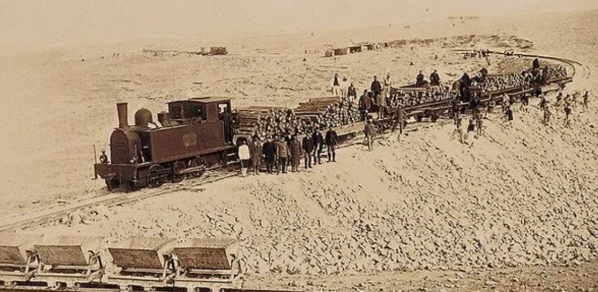
In 1906, for the southern districts, the land register was launched, covering al-Kerak, al-Salt, al-Tafila, and Ma’an. The Ottomans had very little by way of road infrastructure. The King’s Highway and the Hajj Road were two main north-south roads that crossed Transjordan, and settlements developed along these routes. In 1900, construction began for the Hijaz railway and in 1908 Medina was reached. Sultan of the Ottoman Empire, Abdul Hamid II, from 1876 to 1909, and the last Sultan to effectively control the fragile and failing state, celebrated the religious aspects the railway would facilitate.

The railway encouraged the emergence of new settlements, helping shape the borders of new administrative districts in modern Jordan. Extended communication links meant the exposure of the Jordanian market regionally, and two roads linked Jerusalem with Salt, with a bridge built, connecting the two banks of the Jordan River.

The Ottoman Empire remained in control until 1918 in the Arab region and were the first to consider the Jordan River a divide between Liwas. For Jordan, the Ottoman reign meant utilizing the Jordan River as a border between Liwas, while leveraging it for trade and migration which defined this period. Most Liwas had the Jordan River as their border, the only exception being the Liwa of Ajloun.

By the end of the Ottoman era, especially with the production of the PEF map, the triangulation of the maps was much better structured, and the maps were more accurate. The boundary of the Jordan River as a dividing force for administrative and political control was well established and would become the foundation for modern Jordan moving forward.

Categories
Blogs Culture

III. Jordan and the Early Modern Period: Christian Exploration and the Age of Discovery

The Age of Discovery, or exploration, began in the 1400s, as European nations began expanding outwards to explore the world. This age, naturally, intensified and revived cartography, and these new European maps gained rapid popularity by integrating a Christian worldview. This worldview was translated into world maps by placing Jerusalem in the center. The Holy Land representations of the maps indicated heavily that the exploration was Christian. During the 15th to the 18th centuries, these particular maps included both banks of the Jordan, connected across the unifying River.

The 1475 Berlinghieri map was a version of Ptolemy’s map, drafted by the Italian scholar and humanist. 1458 marked a later version, William Wey’s map, drawn on a western-looking landscape, showing a series of population settlements all the way down the eastern and western banks of the Jordan, as if they were medieval castles. William Wey was a famous traveler and author who was born in 1407. The potentially dividing nature of the Jordan River is downplayed entirely to a festival-like interpretation of the region. Wey gives a very religious spin to the map, matching between existing places and biblical names. The northern lake, the lowest freshwater lake on earth, is given four names on the map:  Kinneret, Tiberia, Sea of Galilee, and Gennasereth. The Jordan, and the other rivers, are a uniting, rather than dividing force.  Other maps include the 1459 Fra Mauro map, considered to be the most accurate of its age, drafted by the traveler solider.

Figure 8: William Wey’s Map

Source: Wey, 1867

In 1532 Jacob Ziegler attempted to draw a scientific map of the Levant, though the element of illusion was obvious. In the upper left corner, the sea monster Leviathan dangerously approaches the sphere, representing the origin and longitude around the edges, showing the relationship between myth and science. On the other hand, the northwest direction of the map is much easier to read for modern viewers than the Wey map. As we progress within the ancient maps, we find the maps become progressively more legible. The Jordan River is strategically important at the heart of the map but is not a dividing force within it. There is a series of mountains that host the major settlements. The eastern mountain range, like many other regions of the era, acts as a barrier between the Bible region and the desert on the Ziegler map. The map shows the distance between the eastern mountains and other eastern capitals such as Susa, Babylon and Nineveh. The Mercato map of 1537, drafted by Geradus Mercator, from the County of Flanders, most famous for his world map project, based on the Ziegler map, quotes on it, “Fair reader, greeting! We have drawn this map of Palestine, and the Hebrews’ route into it from Egypt through the stony regions of Arabia.”

Figure 9: Jacob Ziegler Scientific Map

Source: Ziegler, 1532

Henricus Petri’s 1542 map is also based on the Ptolemy paradigm. Its southeastern direction is virtually the exact opposite of the Ziegler map. There is a clear distinction between the East and West Banks of Jordan. The eastern part is sparsely populated and has more forested areas than settlements. The eastern Desert features animals, camel riders, Bedouin tents, and wells (which it seems the caricature user has difficulty pumping!). A sequence of towns and villages east of the desert, seemingly along the Jordan seems to be the barrier between civilization and nature. There is a transfigured Christ who points to salvation in the West, just west of the Sea of Galilee.

Figure 10: Henricus Petri Map

Source: Sebastian, 1545

The 1569 map of Bolognino Zaltieri in Venice follows the style of Madaba’s map, rather than the map of Ptolemy more than any other coast. This is a characteristic of nature. On the corridor between the Sea of Galilee and the Dead Sea, is a line of concentrated trees that form a corridor emphasizing the boundary between the Jordan and the Dead Sea. Rachel Haverelock in The Jordan River in Ancient and Modern Times describes the River as the lifeline of the region.[2] The River flows into Lake Hula, which is North of the Jordan, and as described in the Bible, a twin fountain called “Jor” and “Dan.” A bridge named after James the Bible appears just south of Samachonites Lake, and a Roman bridge crosses the River south of the Sea of ​​Galilee.

The map of Zaltieri, like its predecessor, uses biblical symbols intensively to define the region. There are few landmarks on the east side. The sporadic peaks are intensive. The map gives an aerial perspective of the Holy Land and is spacious and open. We see the Jordan River lined with trees on both banks and incorporating miniature city views, as well as a compass. We see Moses standing on the peak of Mount Nebo in Moab. We see the Dead Sea cities engulfed in flames on the map. We also see on the east bank of the Jordan the figure of Absalom, King David’s 3rd son who raised a revolt in Hebron, hanging by his hair from a tree.

Figure 11: Bolognino Zaltieri’s Map of the Jordan

Source: Zaltieri, 1569

In 1570 Abraham Ortelius’ map in the Theatrum Obris Terrarum (the first modern atlas) was drafted, which has been described as “loaded with theological, eschatological, and, ultimately, para-colonial Restorationism.” Ortelius was a Brabantian cartographer, geographer, and cosmographer.

I will zoom in most in this section to the first world map to have identified Petra on it. Ulrich Bellwald, a Swiss archeologist notes, “The first map which I detected as showing the exact location of Petra, including an abbreviated view of the city surrounded by mountains, was the one in Palazzo Colonna in Rome,” on a map drawn by Bartolomeo Bonomi in 1572. Commissioned by Marcantonio Colonna, an Italian aristocrat serving the Spanish Crown, the map is titled Portolano del Mediterraneo (or simply Mediterranean ports). Bartolomeo Bonomi was neither a surveyor nor engineer, rather an illustrator and engraver.

Colonna fought in the battle of Lepanto, as an admiral in 1571, where the Ottoman Empire defeated a group of Catholic states organized under the Pope at that time, Pius V. The models for the map are assumed to have originated with the Ottomans.  Indeed, Colona references Kitab-i-Bahriye (which in English means the Book of Navigation) by Hadji Ahmed Muhiddin Piri, published in 1521 as the source. On Piri’s map we see cities such as Petra and Damascus, in addition to the major ports.

The implications of this map are such that the Swiss Johann Ludwig Burckhardt, a famous orientalist, visited the region with full knowledge that Petra must be located within the Wadi Musa area. He was ultimately credited in 1812 with having “discovered” Petra and introducing it to the West.

Piri’s 2nd edition was printed in 1525. By the 3rd, it had gained even more popularity, and included maps that were more modern from the Italian cartographers Jacopo Gastaldi and Battista Agnese, and the Dutch Abraham Ortelius. The fact that western cartographers were featured in an eastern atlas shows the influence and cooperation between the two worlds through maps.

Figure 12: Petra in Map – Hadji Ahmed Muhiddin

Source: Rawashdeh, 2019

The northwest orientation of the maps of Europe in the 17th and 18th centuries is consistently used. Maps of this period are fairly uniform in terms of the amount of data contained, irrespective of whether they explicitly note place names, and whether or not they include decorative features. All of them depict the eastern bank of the Jordan River, and most of them also include the Eastern Desert. These maps are not interested in modern settlements and preserve and reconstruct the biblical kingdom. In other words, the geographical projection of the map recreates historic Israel while creating a completely Christian environment.

Other maps include Christian van Adrichem, a Dutch priest in 1590; a 1620 translation into Hebrew of this map by Jacob ben Abraham Zaddiq; a 1655 map by Christoph Heidmann from his Palestina siue Terra Sancta;  a 1657 map by Philippe de La Rue; others in 1714 by Adriaan Reland,  Dutch Orientalist scholar, cartographer and philologist; 1745 by Richard Pococke, an English-born churchman, inveterate traveler and travel write,  depicting the Holy Land and Syria; and 1794 by the French Jean Baptiste d’Anville, who improved the standards of map-making.

It is during this period that we see a shift towards more scientific and accurate drafting of the physical landscape. However, the Christian worldview dominates, and maps continue to celebrate religion. During this time, there was also more of a focus on the map’s orientation. It generally appears that how far east the maps extend depends heavily on the data sources of the maps, from religious or historical and political sources. In addition, we see some Western cartographers starting to internalize the Ottoman rule boundaries, a topic we will explore more in the next post.

Categories
Blogs Culture

II. Jordan and the Ancient Bible World: Understanding Geography through Religion

The Ancient Maps are religious in nature and caricature the landscape to fit a religious and spiritual ideology. Through the history below you will see Jordan portrayed as a land of prophets, with cartoons of religious figures scattered throughout maps that are not scientifically nor geographically accurate. Rather, these maps depict the imagination of their drafter. I will examine most closely the famous Madaba Map that is celebrated in Jordan.

The earliest map of the Jordan area is thought to be Ptolemy’s Asia Map drafted in 150AD. Ptolemy’s works in antiquity were thought to have been atlases with attached maps. However, no manuscript of his Geography, a graphical atlas of the second century Roman Empire, survived earlier than the 13th century. It is such that the earliest version we see is actually a copy from Ptolemy’s books, of a map which was then assembled by Maximus Planudes, who was a Byzantine scholar in the year 1300. The map was considered the first attempt at delineating the region. There are large letters in the center of the map which are written in Greek and are translated to Palastinis (Palestine).

The most significant feature in this map of the Levant region in the Middle East, is the Jordan River, which is clearly highlighted in blue. The Jordan is not a dividing force in this map, rather a feature of the landscape around which identical settlements are portrayed.

Figure 1: Map of Ptolemy

Source: Ptolemy, 150AD

It was 250 years later that the Notitia Dignitatum map, a document from the period of the Roman Empire, which accurately represents the Western part of the Empire, and the Byzantine Empire during the years 390-420AD was produced. The map has no author and is one of the few surviving documents of the period. The Fl Jordanis or the Jordan River is drawn near the center of the map with castles on either side (see Figure 2 below). The map seems to reflect a cohesive terrain, settled by friendly and similar rulers, with the Jordan River more of a small stream that can be crossed, rather than a major natural barrier, separating two separate entities. There are exaggerated animals, and comical sized castles, compared to the size of the Jordan, reflecting the understanding of the cartographer of “rulers” alone defining the landscape.

Figure 2: Map of Notitia Dignitatum


Source: Notitia Dignitatum, 400AD

Then comes the Madaba Map which I am going to zoom in on, as the major cartographical feature of this age. Its discovery is important to record, as it prompted the beginning of massive interest and exploration in Jordan.

In 1901, Meletios Metaxakis of Crete entered Madaba. His journals would reflect much of his experiences there. The earliest Madaba or “Medaba” as it was written is in the Bible, Numbers 21:30, during the conquest of several other Moabite cities by the Amorite King Sihon of Heshbon. A feisty little settlement, Madaba continued to play a role in the Hellenistic period conflicts. In AD 106, following the Nabateans’ defeat in Petra by Trajan, the entire region was incorporated into the Roman Province of Arabia. During the late Roman period, Christianity took root in Madaba, and the village saw a Bishop as early as the mid-5th century.

During the 38-year reign of Emperor Justinian starting in AD 527, Madaba flourished. North of the Church of St George is an inscription crediting him with renovating the structure. It was indeed during the 6th to 8th centuries that the church with the mosaic Holy Land map was built, along with the Burnt Palace and the Hippolytus Hall. Madaba continued to flourish after the Umayyad caliphate was established in Damascus, following the Islamic conquest. The late Byzantine and early Islamic periods were rich, and Madaba was saved from the gradual decline of other cities from about the mid-6th century until the Western Europeans began to arrive in the 19th century Middle East.

The first European to visit Madaba was the German explorer Ulrich Seetzen in 1806. The Swiss man, Johann Burckhardt who was initially thought to have introduced Petra to the western world, followed him a few years later, and noted the water collection and storage system.

The 1868 discovery of the Moabite Stone in Dhiban caused enough excitement for an entire generation of aspiring archaeologists to become fascinated by Jordan. The Stone, which is also known as the Stele of King Mesha, is one of the most important direct accounts in the history of the world about the Bible. It is etched in a variant of the Phoenician alphabet, paying tribute to the sovereign, celebrating his great works during the reign of Ahab, son of Omri.

This discovery in Transjordan and the constant expeditions that followed saw one led by Henry Baker Tristram in 1872. Tristram was especially attracted to Madaba as a treasure of ancient ruins. When Claude Conder, the 23-year-old English Lieutenant, visited Madaba in 1881 he noted the presence of a group of Christians who had come in from Karak and were living in caves. As these families moved closer to the center, they built directly upon the foundations of ancient structures, and revealed mosaics as a result. Some of these mosaics became the floors of their new homes. In 1884, the Holy Land map from the Byzantine period was discovered and caused a stir.

The early Christians in Karak, from the crusader South of Jordan, received refugees from Madaba, Maeen and Petra, after their villages were attacked. By the 1880s, ninety Christian families from Karak returned to Madaba.  They were encouraged by the Latin Patriarchate of Jerusalem who sent two Italian priests to guide them. They intended to build churches in their home settlement. The rule was any new church had to be built upon the remains of an old church.

At the request of the Christian families, the Holy Synod of Jerusalem in May 1892 approved the construction of a church in Madaba. Certain modifications were requested. By 18th September 1892, sufficient reconciliation had taken place and the plans were fit onto the foundation plan of the ancient church. The plans were ultimately sent to Damascus to be forwarded to Constantinople for final approval. Two years later the Patriarch of Jerusalem, Gerasimos, granted the Holy Synod permission to begin construction upon receiving approval from Constantinople in 1894. Almost a month later the architect Atanasio Andreakis, in the company of Deacon Germanos, representing the Patriarchate to Madaba, was welcomed by the villagers. On the 23rd of October 1894, the excavations began to uncover the foundations of the old church. By 20th of August 1896, the construction of the church and its roof had been completed; and the architect was ready to proceed to the next steps to plaster the interior walls and pave the floor. Later that year, while sifting through the debris, workers came upon a mosaic pavement.

Having found the mosaic, Andreakis left for Jerusalem to request their help in providing him with a mosaic expert. And so it was that the young scholar Cleopas Koikylides was ordered by Photios, the deputy to the Patriarch, to return with Andreakis on a tour of Christian Orthodox communities in Transjordan and examine the mosaic map in Madaba once he arrived there.

The mosaics in Madaba form a map and it is considered the most historic surviving illustration of the Holy Land, and specifically Jerusalem. It covers a region that stretches from Lebanon to the Nile Delta, and from the Mediterranean Sea to the Eastern Desert. The Madaba Map shows two fish swimming in the Jordan, two fishing boats on the Dead Sea, and bridges connecting both sides of the Jordan River. All locations are marked with names and descriptions in Greek. The Jordan River is the most important location on this map connecting two biblical areas of importance. One of the two fish portrays a miserable look as it swims away from the Dead Sea. The other shows no emotions as it is possibly unaware of the Dead Sea that lies ahead of it. The Madaba Map is of massive importance as it is referenced by scholars for matters relating to biblical sites. In addition, the Madaba Map possibly shows all biblical sites found in the Levant region.

The Madaba Map’s purpose has yet to be determined. Scholars have speculated that it may have served as a pilgrimage guide for early Christians, although its permanent location in a church seems to preclude this idea as pilgrims typically required quick, practical assistance. Irfan Shahid, reviving an older theory, claims that the map depicts Moses’ final vision of the Promised Land from atop the Transjordanian peak of Nebo. Shahid goes on to say that the 6th century was a pivotal period in Moses’ Christianization and the crystallization of the Christian Holy Land. These maps appear to have been used to construct, in addition to reflecting, Christian history.

Figure 3: The “Madaba Map”

Source: Madaba Map

Finally, there was the Beatus Map which was one of the most important maps in the early period of the Middle Ages. It was drafted by Beatus, a Spanish monk, and was based on the maps mentioned earlier and the Bible, and Ptolemy’s narrative and Isidore of Seville, a Spanish scholar and cleric. This map was the first “Christin World Map” and is not an exact world map. The map appears at the start of Beatus’ 2nd work, Commentary on the Apocalypse. The Beatus Map divided the region into a few distinct areas: the Sea of Tiberiades, where many of the apostles worked as fishermen, Galilee, where they crucified Jesus Christ, and Monte Tabor, the location of the Transfiguration. The work assumes that the earth is a flat plane, and though attempts to be scientific, the exaggeration of certain geographical features, celebrating the Jordan River, reflects a very myopic understanding of the world at that time. In addition, the map is oriented eastwards rather than the standard north.

Figure 4: Beatus Map

Source: Beatus Map

From 639-775 during the early Islamic period, the Rashidun, Umayyad and Abbasid caliphates, the Jordan of today was known “Jund al-Urdunn” or the Jordan Legion, a province stretching over the north and the Jordan River. Tiberias – Tabariyya was its capital city and its boundaries extended perpendicular to the Mediterranean, accompanied by two other Paletnian Legions.

In the 12th century, the Crusaders occupied the Bilad al-Sham (Levant), and the ancient world’s geography came to an abrupt halt. The system of “Niyabat” was introduced, and these can be thought of as provinces or kingdoms. The largest was Damascus, and it included the north of the Jordan River, and Lebanon. The remainder of Jordan was assigned to the Kingdom of al-Kerak and remained so for the Ayyubid and Mamluk eras. To administer the Niyabat, they were further divided into subdivisions called “Amal” (these included Amal Ma’an for instance). There were five Crusader castles built across Jordan. They were mostly built during the 12th century and served as important parts of the Crusades.

The oldest surviving European sheet map, during the crusader age, in the 1100s, was the Ashburnham Libri map.

Figure 5: Ashburnham Libri Map

Source: Ashburnham Libri, 1100

The Tournai Map of the twelfth century is a copy of the map of Asia, of a 4-5th century work of Jerome (or Saint Jerome), who was a priest, historian, and theologian. The map shows the Mediterranean Sea on the bottom right, the Black Sea and Caspian Sea on the left, and the Indian Ocean on top. There is much exaggerated importance given to the Jordan River and Holy Land. Divisions are drawn undermining nature and celebrating man-made territories. This period also saw a 1250 Oxford Outremer map by Matthew Paris, an English Benedictine monk, who quotes on his map the text “This river, which is small, divides Syria from Palestine, that is, the Holy Land, which is to the south, and Palestine, which is to the North.” The year 1300 marked Buchard of Mount Sion, a German priest, Dominican friar, pilgrim and author who traveled to the Jordan region and documented his journey in the Holy Lands, producing his first map.

Figure 6: Tournai Map of Asia

Source: Tourani, 12th Century

There was also the Sanudo-Vesconte map in 1320 drafted by the Genoese geographer Pietro Vesconte, a cartographer who pioneered mapmaking in the 1300s to 1400s and is credited with the creation of the portolan nautical chart and influenced mapmaking throughout the 14th and 15thcenturies. This map, seen in Figure 7 below, is the first non-Ptolemaic map, and rekindled the spirit of the crusades in a modern map effort.  The Jordan River is enormous, and almost looks like an ocean along the bottom of the page. There appears to be nothing beyond it, the world is interpreted through the eyes of the early Crusaders, leading to the next section.

Figure 7: Sanudo-Vesconte Map

Source: Marino Sanudo, 1320

The ancient maps of the Jordan region usually reflected Jordan’s importance as a Christian historical location, however, they did not give attention to the accurate size of the region scientifically and were rather cartoon-like. Celebrating the Jordan River, these maps did not move much beyond a mapping of biblical sites to reflect the geography of the area.

Categories
Blogs Culture

I. Introduction to Mapping Jordan

The Hashemite Kingdom of Jordan is home to many important religious sites including Mount Nebo (where Moses looked over the Holy Land), Bethany Beyond the Jordan (where Jesus was baptized), Machaerus (the palace where John the Baptist was beheaded), Umm Qais (where Jesus performed the Miracle of the Gadarene Swine), and finally Pella (where the Bible says Jacob wrestled with God all night in the form of an angel). Starting from the Ancient World, the land that is known today as modern Jordan was home to the City of Jericho in 9000 BCE, and since then, its terrain has hosted the Ain Ghazal, Hyksos, Egyptian Pharaohs, an invasion of the Sea People, Alexander the Great, and the Roman Empire. In 718 CE, Jordan was ruled by the Abbasids, then the Crusaders, Ayyubids, Mamluks, and the Ottomans. After that, it was under British Colonial Rule until 1946. In the 20th and 21st centuries, Jordan played an active political role in the Middle East based on its geographical location.

The rich and complicated history of Jordan is difficult to capture in a concise, and cohesive manner. For my research, I turned to maps as a tool to discuss this complex and evolving past, through its various eras and unique politics, in an accessible way that makes conceptual sense. I found that indeed, this vibrant history is best depicted in the maps of Jordan.

Maps can be used to uncover lost civilizations, they depict the world in a simple way, while helping users visualize borders and geographies. Maps capture politics, as well as religious and cultural norms. They show us graphical descriptions of a past in a way that is sometimes a lot clearer than written history. On maps, boundaries are forced, and politics are made explicit. More than written history, maps force exaggerations, through representations of the world in lines, colors and keys.  Through my research into maps, I was able to break Jordan’s history into four main periods:

  1. The Ancient Bible Period: From around the 6th century with the Madaba Map which is one of the oldest mosaic pieces of ancient cartography. It is interesting to note that many of the maps, especially in the ancient Bible period focus on the area as the spiritual-religious center, with the East of the Jordan (the area of modern Jordan today) underplayed in importance.
  2. The Early Modern Period: In the 16th century, European maps depict the Holy Lands as a location of salvation. This is represented in maps such as Ventetian Bologni Zalteri’s 1569 map.
  3. The Ottomans and 19th Century Maps: The administrative divisions of the Ottomans coincided with an elevation in scientific methodology in cartography. This period marked the beginning of the age where maps drifted towards the historical and more accurate.
  4. British Colonial Rule: This was marked by T.E. Lawrence who created a hypothetical map ultimately prophesizing the creation of what was then known as Transjordan, which eventually became today’s Jordan.

Throughout these vastly varying political regimes, the natural landscape of Jordan was unchanged. In this essay, I will explore how the interpretation of physical landscapes on man-made maps varies according to the mapmaker. Despite cartography being framed as a science, maps are unique, and change based on the mapmaker and how they are influenced by scholarship, culture, and art, amongst other things. Despite maps being considered objective in their reflections of realities on the ground, through my research I will look at maps as political tools that reflect the construct of a world that is biased based on the cartographer’s own age, mirroring features important to their worldview, insulated from natural realities and topographical truths. This is especially true with how the Jordan River is reflected historically in certain maps. I will zoom in on certain maps to look at their history of discovery, preservation and how they were made, as their stories influence cartographers that came after them.